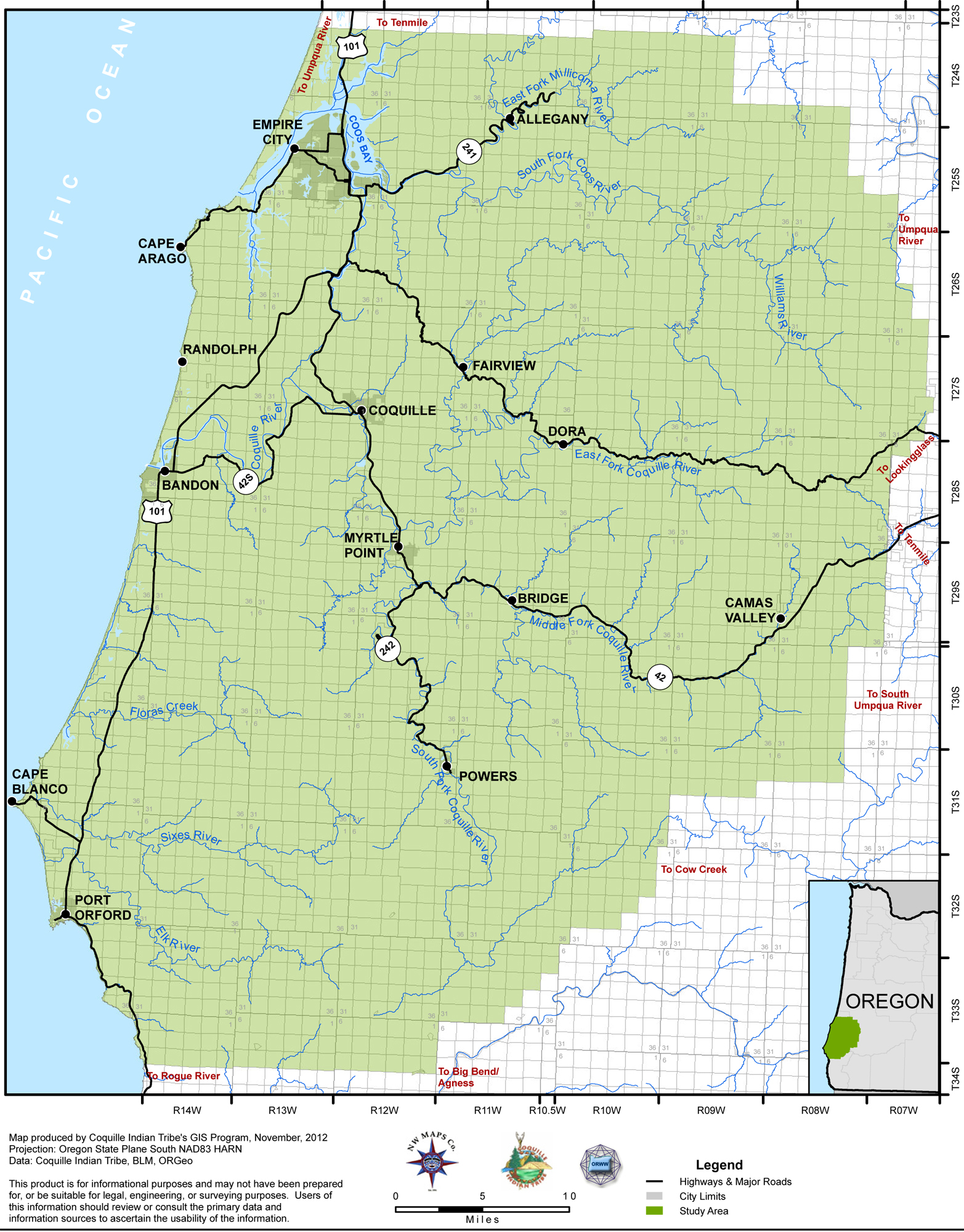
To examine the history of Randolph, I’m first sharing a historical account (copied verbatim) that clearly and concisely describes the place Peterson and Powers call “Randolph-the-First.” The map below shows it situated south of Cape Arago on the Pacific Coast.

Randolph-the-First: A Historical Account
“Gold was discovered at the mouth of Whiskey Run in the winter of 1852-1853. Before long a camp had sprung up along the beach. Sober citizens soon began calling the place Randolph. The camp grew rapidly. Each day saw the arrival of new miners. Before spring, storekeepers were weighing out flour, sugar, and coffee. Miners, up from the sluices on the beach, warmed chilled bones in improvised saloons, the steam from their sodden garments mingling with the reek of whiskey, wood smoke, and kerosene. Along the beach, honeycombed by the workings of the miners, at the mouth of the creek that is still called Whiskey Run, against a somber background of densely-wooded hills, sprawled the town, a jumble of board and log houses with shake roofs, stone and mud chimneys, oiled-paper windows, and puncheon floors. Pack mules floundered deep in the mud of the streets . . .
“Randolph-the-First (there were others) was short lived. A terrific storm that lashed the coast in the spring of 1854 obliterated most of the gold-bearing black sands, burying sluice-boxes and shafts under dunes of prosaic gray grit. While miners loafed, waiting for the sea to sweep the worthless sand away, a prospector, later known as “Coarse-Gold Johnson,” made another find on a southern tributary of the Coquille. The stampede to the new diggings half emptied Randolph over night.
“Randolph just faded away. But it left a name known as the Randolph Trail, leading out of Empire, through the heavy coastal timber and shrubbery, crossing sloughs and gullies, following ridges, always in a southerly direction through a country now commonly referred to as the Seven Devils, ending at the gold diggings on the beaches north of Coquille River.”
Peterson and Power’s account outlines the basic narrative arc of the history of Randolph. I also appreciate its brevity—even though there’s more to the story. Sticking to the basics for now, though, I next want to write about why this mining camp-town near Whiskey Run became known as Randolph.
Sources
“Ghost Towns: Randolph,” Peterson, Emil R, and Powers, Alfred. A Century of Coos and Curry. 1977 ed. Coquille, OR: Coos-Curry Pioneer and Historical Association, 1952, page 133.
Zybach, Bob, Don Ivy, and Robin Harkins. “Map_02_Index.Jpg (JPEG Image, 1565 × 2000 Pixels) — Scaled (46%).” Coquelle Trails, Study Area Maps, 2012. http://www.orww.org/Coquelle_Trails/Maps_1856-2012/Study_Area/Map_02_Index.jpg. Fair use permission stated on website: “digital and print maps intended specifically for the use of students, teachers, and interested public.”